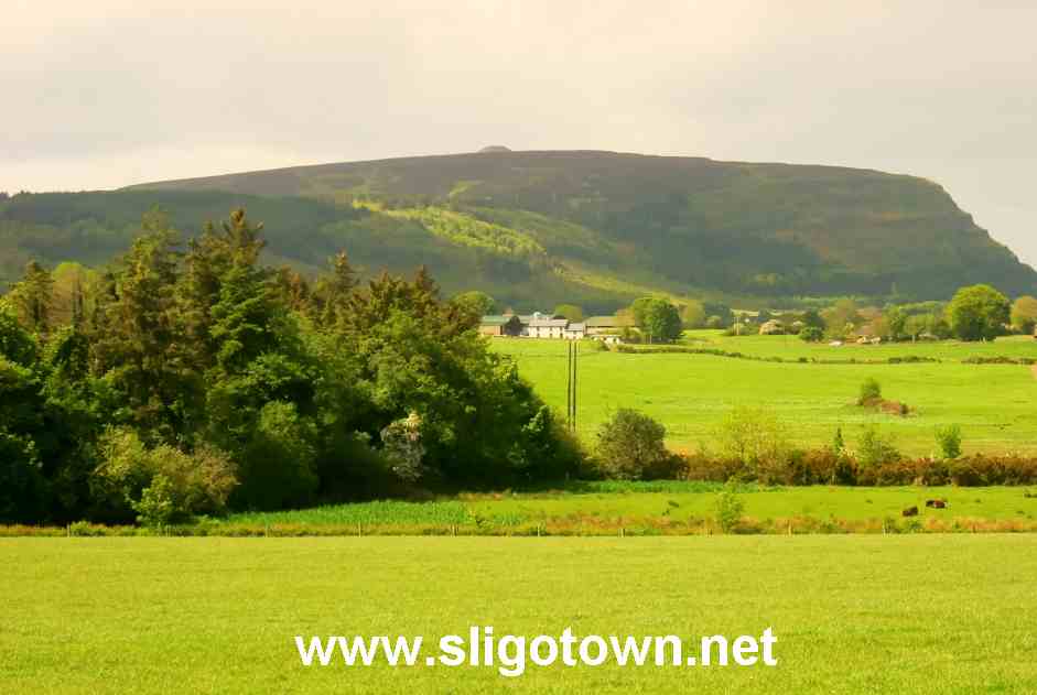
 The skyline to the west of Sligo Town is dominated by the very distinctive outline of the majestic Knocknarea mountain.Knocknarea (Cnoc na Riabh) or Hill of the Executioners, is situated about 4 miles west of Sligo Town on what is known locally as Coolera or the Strandhill Peninsula.
The legend of Queen Maeve‘s death is very bizarre, according to an 11th Century writing, she is said to have been killed by a sling-shot, consisting of hard cheese, which was fired by her nephew.
To see the wonderful views from the top of Knocknarea Mountain and to see the 40 foot high stone cairn and the other remains on the top of the mountain, you must walk up the mountain on foot as there is no access to motor vehicles to the summit.
First of all, I’m not the fittest person in the world, but I’ve regularly climbed Knocknarea Mountain, sometimes I’ve been on my own and have taken as little as 25 minutes, other times I’ve dragged members of my family or some friends up for the walk with me, which takes only a little longer.
To get to the car park at the start of the walk towards the summit of Knocknarea Mountain, first of all go to Sligo‘s joint bus and railway station, take the road straight opposite the station entrance, Wolfe Tone Street, to its far end, then turn right at the end of the road.
Follow this road past Nazareth House on the left and The Showgrounds, home of the Sligo Rovers football team on the right, follow the road without turning off to the left or right for about 3 miles, until you come to Primrose Grange, an old school house on the right-hand side, which is now a bed and breakfast.
Less than 100 yards past Primrose Grange you turn right at the sign post for ‘Knocknarea Mountain Car Park’, park your car in the car park and enjoy the leisurely one point two kilometre walk to the summit.
It is a local tradition to pick up a stone or a small rock on your walk to the summit, and to leave it at the cairn.
Initially the path is of very rough stone, frequently populated it seems by cattle mess and tractor tyre marks, though in all the times I’ve walked up the mountain, I’ve never met a cow or a tractor on the path.
When you come to the small stile / gate, if you haven’t already, take a rest and have a look at the scenery unfolding behind you. You can see the quarry in Ballysadare very easily, perhaps even the church spire in Collooney.
On my most recent assent of Knocknarea on 3rd May 2011, I noticed a large amount of large stones / small rocks had been scattered on all of the walking routes on Knocknarea. I found these stones to be extremely dangerous, especially whilst descending the mountain, as they are loose underfoot and had a tendancy to shift whilst under my feet, resulting as they did, in me twisting my ankle slightly on one occasion and falling onto the flat of my back on another occasion whilst descending the mountain, resulting in cuts to my hand and back and with a severe soreness in my knee and my shoulder.
Continuing up the mountain, after reaching the stile/gate you enter onto open farmland and the path now gets quite steep and will get ever more severe before you reach the summit, but no matter how severe the path becomes, its been worn away into steps by all the feet who have passed this way previous to your own.
Once you have got to the top of the steepest section it levels out very quickly and after 3 minutes walking and getting your breath back, Queen Mauve’s Cairn will come into view.
This is an incredible experience and something which I feel every time I climb Knocknarea Mountain, the feeling of being absolutely exhausted by the severity of the middle part of the journey to the summit, quickly followed by the sight of the cairn ahead of you, gives the feeling that its all been very worthwhile.
Whilst at the summit take a walk around, most people go as far as the cairn and thats it, I’ve brought other walkers for a good long walk right across the top of the mountain, where we’ve looked down onto Strandhill village and onto Culleenamore Bay, we’ve even experienced the unusual sight of looking DOWN on an aircraft, on its final approach and landing at Strandhill Airport, an unusual sight indeed.
Apart from Queen Maeve’s Cairn, which, although never excavated, is believed to contain a passage tomb dating back to 3,000BC, you will also see a number of kerb-stones and within 5 metres of the cairn itself lie two large stones which have been interpreted as being North and South markers.
Some 150 metres to the North-East lie the foundations of 5 circular and oval hut sites, from which excavations have uncovered hundreds of flint and chert scrapers, arrowheads, a polished stone axe and some pottery which have been dated to about 3300 – 2700 BC.
You are no longer allowed to climb to the top of the cairn, as the structure is unfortunetely being worn away by the continual pounding of peoples feet.
Now its time to return to the car park. Remember to take extreme care on your descent, especially on the very steep middle section, as it is very easy to lose you’re footing and go for a tumble as I did.
Comments are closed.